Solomon Valley Highway 24 Alliance
  • Home
    • Donate
    • Site Map
  • SVHA
    • About Us
    • Our Accomplishments
    • SVHA News
    • President Message
    • Valley Voices Archive
  • Discover The Valley
    • About the Valley
    • Community Histories
    • Historical Accounts >
      • Robert McBratney
    • Water/Ways >
      • Robert McBratney
      • Bridging The Solomon
      • Water Power
      • Journeys End
      • Webster Dam
      • Ground Water Issues
      • A Sacred Promise
  • Attractions
    • Places of Interest
    • Community Kiosks >
      • Peace Pole
    • Museums
    • Libraries
    • WW II Memorial Highway >
      • Riley County
      • Clay County
      • Cloud County
      • Mitchell County
      • Osborne County
      • Rooks County
      • Graham County
      • Sheridan County
      • Thomas County
  • Amenities
    • Dining
    • Lodging
  • Locate Us
  • Membership
    • Membership Information
    • Membership Signup
    • Member List
Living Off the Water: ​The Challenge to Tame and Sustain Life in the Solomon Valley
Shared human experiences with water along the Solomon River from Glasco to Hoxie, Kansas.
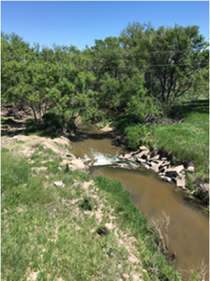
Ground Water Issues
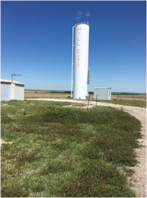
Graham and Sheridan County, Kansas

Water: The Bottom Line... A Statement, A Second Source
Picture
Picture

A Statement
During the long, hard first winter, 1877-1878, African-American colonists carried water from a creek and figured out what they needed to do to survive:  They needed to dig a well.
 
Digging a well was extremely dangerous — cave-ins, lethal gases, collapsed walls — added to the physically taxing process.  Well-digging was never attempted unless persons intended to stay in a town or on a claim.  The Nicodemus town well proclaimed the African-American colonists’ intent to remain on the plains in Graham County. 
 
*From Nicodemus: Post-Reconstruction Politics and Racial Justice in Western Kansas (2016), Charlotte Hinger.
Picture
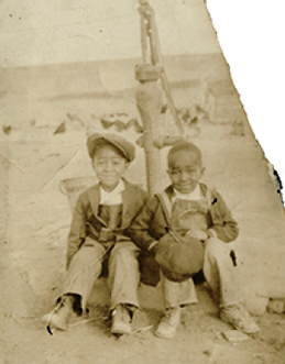
Photo courtesy of Nicodemus Historical Society, Kenneth Spencer Research Library, University of Kansas Libraries
Picture
Picture
Photos courtesy of Alan LaSage
A Second Source
A century later, shallow wells that tapped the high ground water along the South  Solomon River through Graham County had to be abandoned.  Oil production and agricultural run-off contaminated Morland’s municipal water well source.

​A fresh supply of high quality water was drawn from the Ogallala Aquifer several miles north of Morland.

*From Morland History, (2001) unpublished manuscript, Faye Minium. Alan LeSage.
​The National Picture  --  Ground Water Context
From being the uninhabitable Great American Desert to becoming the breadbasket of the world, then confronting resource realities and yielding that distinction.  This is the arch of High Plains agriculture.  It reflects water—technology—electricity—flowing through time.
 
Water accumulated for 15,000 years in the underground Ogallala Aquifer.  Settlers tapped the Aquifer with wells with windmill driven pumps, allowing farmers a foothold on the plains.  This modest degree of dipping into the Ogallala Aquifer could have continued for a long time, supporting life engaged in dryland farming.
Picture
Picture
​In the 1930s, President Franklin D. Roosevelt’s Great Plains Committee noted the contradiction basing farm economy on a finite resource, the aquifer.
 
In the 1940s, rural electrification allowed pumping water to irrigate.

In the 1950s, mining water with center-pivot irrigation, sprinkler systems, with diesel-powered centrifugal pumps.

​2000s, returning to dryland farming with depletion of the aquifer.  Climate change, hotter and drier,  increases water needs of livestock and crops.   Turn to mining the wind, an inexhaustible resource. ​
*Insights from National Geographic Magazine, October, 2016.
Harvest photos courtesy of Ft. Hays State University Alumni
​October 21. Water Clear and Pure, and excellent for drinking.
    *from McBratney Diary Quotes – Continuity in Water/Ways Exhibit From the Original 5 x 7 inch red leather receipt book
Picture
Read More Of The Diary: 
  • Robert McBrantney Diary, 1869 Solomon Valley Expedition

Select Below to Read More Water/Ways Stories
R. McBratney  |  Bridging The Solomon  |  Water Power  |  Journeys End  |  Webster Dam  |  Ground Water Issues  |  A Sacred Promise
Picture
Contact SVHA
785-425-6881  |  E-mail SVHA


Select Below For More Information
Sheridan County
Hoxie 
Tasco
Cottonwood Ranch
Studley
Graham County
Morland
Penokee
Hill City
Bogue
Nicodemus
Rooks County
Damar
Webster State Park
Webster
Stockton
Woodston
Osborne County
Alton
Bloomington
Osborne
Portis
Downs
Mitchell County
Cawker City
Glen Elder
GE State Park
Solomon Rapids
Beloit
Asherville
Simpson
Cloud County
Glasco
Make a donation
to SVHA
​Site Updated 03-16-23
  • Click Here to Become A Member
  • Discovered a problem with our site? ► ​Email Us
Website by Limestone9 Consutling
Majority of Site Photos Courtesy of Greg German
  • Home
    • Donate
    • Site Map
  • SVHA
    • About Us
    • Our Accomplishments
    • SVHA News
    • President Message
    • Valley Voices Archive
  • Discover The Valley
    • About the Valley
    • Community Histories
    • Historical Accounts >
      • Robert McBratney
    • Water/Ways >
      • Robert McBratney
      • Bridging The Solomon
      • Water Power
      • Journeys End
      • Webster Dam
      • Ground Water Issues
      • A Sacred Promise
  • Attractions
    • Places of Interest
    • Community Kiosks >
      • Peace Pole
    • Museums
    • Libraries
    • WW II Memorial Highway >
      • Riley County
      • Clay County
      • Cloud County
      • Mitchell County
      • Osborne County
      • Rooks County
      • Graham County
      • Sheridan County
      • Thomas County
  • Amenities
    • Dining
    • Lodging
  • Locate Us
  • Membership
    • Membership Information
    • Membership Signup
    • Member List