Solomon Valley Highway 24 Alliance
  • Home
    • Donate
  • About
    • Hwy 24 Alliance
    • Our Communities
  • Attractions
    • Places of Interest
    • Community Kiosks >
      • Peace Pole
    • Museums
    • Libraries
    • WW II Memorial Highway >
      • Riley County
      • Clay County
      • Cloud County
      • Mitchell County
      • Osborne County
      • Rooks County
      • Graham County
      • Sheridan County
      • Thomas County
  • Amenities
    • Dining
    • Lodging
  • Events
    • Current
    • Upcoming
  • Locate Us
  • Membership
    • Membership Information
    • Membership Signup
    • Member List
  • Archives
    • History of SVHA
    • About the Valley
    • Our Accomplishments
    • Community Histories
    • Historical Accounts >
      • Robert McBratney
    • Water/Ways >
      • Robert McBratney
      • Bridging The Solomon
      • Water Power
      • Journeys End
      • Webster Dam
      • Ground Water Issues
      • A Sacred Promise
    • Valley Voices Archive
Living Off the Water: ​The Challenge to Tame and Sustain Life in the Solomon Valley
Shared human experiences with water along the Solomon River from Glasco to Hoxie, Kansas.

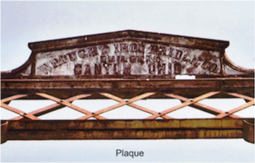
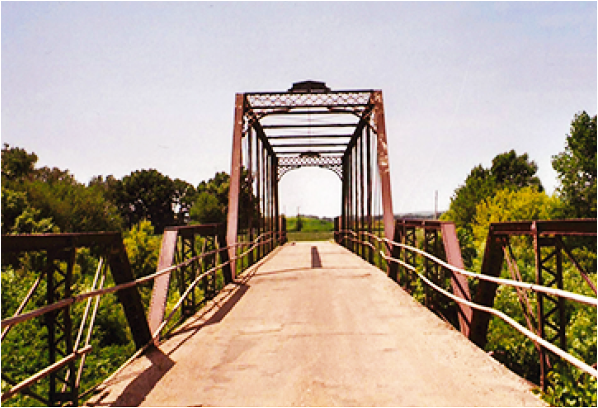
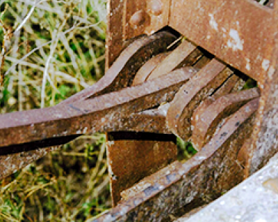
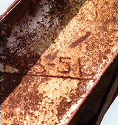
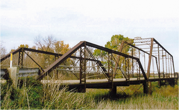
Bridging the Solomon River
Glasco, Kansas
Picture
Picture

Two towns, Glasco and Simpson, worked to have the Kansas State Legislature approved bridge located near them. From June, 1883 to June, 1884 voters considered the advantages of a bridge. 
    *from The Glasco Sun
 
Why Have A Bridge At Pott’s Ford?
  • shorten farm to market trip    
  • enable voting if water high at election time    
  • maintain access to mail, mill, church and medical service    
  • give a boost to Glasco economy
Picture
Picture
When Was The Bridge Built?
  • August, 1884, Wrought Iron Bridge Co. was commissioned to complete the bridge in 90 days.
Where Was It Located?
  • Southwest of Glasco, on a bend in the road.  It was misaligned so provided a right angle approach to the river. Shortening the bridge length was economical.
What Kind Of Bridge?
  • The Pratt truss bridge was one of 9 truss bridges built by the Wrought Iron Bridge Co. in Kansas.  A total of 262 Pratt truss bridges were built in Kansas. The pin connected bridge was assembled on site.
    ​
Historic Designation — Action by KDOT and KSHS
  • When?   January 4, 1990, the bridge was placed on the National Register of Historic Places.
  • Why? In order to preserve for posterity examples of each type of bridge.
The Pott’s Ford Pratt Truss Bridge Was Rated High In Significance.
  • Age — One of the oldest Pratt in the state. 
  • Builder — A known, out-of-state builder.
  • Integrity — Retained a good degree of integrity.  *Potential—For a by-pass
  • Historic Symbol — Of the struggle between early Kansas communities. 
  • Why built — Struggle for security and safety
    ​
Picture
Current Condition of the Pott’s Ford Bridge
  • Location? 40th Road, southwest of Glasco.
  • Status?   Open to traffic, no restrictions.
  • Inspection? January, 2015
  • Deck condition -- Satisfactory (rated 6 out of 9)  *Superstructure condition—Fair (5  out of 9)
  • Substructure condition — Poor (4 out of 9)   
  • Appraisal — Structurally deficient
  • Sufficiency rating — 28.5 out of 100    
  • Average daily traffic — 25
Picture
Picture
Picture

​Looking Ahead
  • What? Is there action that should be taken now?
  • Why? Early Glasco citizens fought to have the bridge built.  Today’s Glasco citizens may be able to protect it in order to ‘preserve for posterity’ this fine truss bridge.
Photos on this page courtesy of Robert Elder
​October 24 – On the creeks we were obliged to dig and to use the lariats in letting down and pulling up the wagons. The creeks have cut down their beds to 25- to 30 fee through the loamy soil; their bottoms were narrow and their sides steep.      *from McBratney Diary Quotes – Continuity in Water/Ways Exhibit From the Original 5 x 7 inch red leather receipt book
Picture
Read More Of The Diary: 
  • Robert McBrantney Diary, 1869 Solomon Valley Expedition

Select Below to Read More Water/Ways Stories
R. McBratney  |  Bridging The Solomon  |  Water Power  |  Journeys End  |  Webster Dam  |  Ground Water Issues  |  A Sacred Promise
Picture
Contact Hwy 24 Alliance
785-425-6881  |  E-mail US

  • Click Here to Become A Member
Site Updated 02-07-25
U.S. Highway 24 Alliance logo
Discovered a problem with our site? ► ​Email Us
Make a donation to
the Hwy 24 Alliance


Website by Limestone9 Consulting
Majority of Site Photos Courtesy of Greg German

  • Home
    • Donate
  • About
    • Hwy 24 Alliance
    • Our Communities
  • Attractions
    • Places of Interest
    • Community Kiosks >
      • Peace Pole
    • Museums
    • Libraries
    • WW II Memorial Highway >
      • Riley County
      • Clay County
      • Cloud County
      • Mitchell County
      • Osborne County
      • Rooks County
      • Graham County
      • Sheridan County
      • Thomas County
  • Amenities
    • Dining
    • Lodging
  • Events
    • Current
    • Upcoming
  • Locate Us
  • Membership
    • Membership Information
    • Membership Signup
    • Member List
  • Archives
    • History of SVHA
    • About the Valley
    • Our Accomplishments
    • Community Histories
    • Historical Accounts >
      • Robert McBratney
    • Water/Ways >
      • Robert McBratney
      • Bridging The Solomon
      • Water Power
      • Journeys End
      • Webster Dam
      • Ground Water Issues
      • A Sacred Promise
    • Valley Voices Archive